Production area and field inspections under the Central Valley dairy order
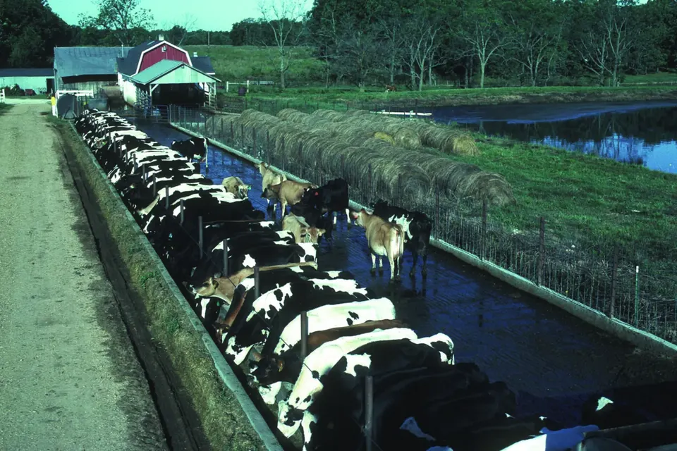
Of all the requirements in the Central Valley dairy order, routine visual inspections are the simplest and among the most useful. A person walks the ponds, corrals and fields on a fixed schedule, looks for anything that could lead to a discharge, and writes it down. Done well, they catch a slumping berm or a pond running out of room weeks before it becomes a spill.
The schedules below are those of the Monitoring and Reporting Program attached to Order R5-2013-0122. A dairy enrolled under an individual order, or subject to a later order of the regional board, should follow the text that applies to it.
The production area
Weekly from October to April, monthly from May to September
The order divides the year into a wet season, from 1 October to 30 April, and a dry season, from 1 May to 30 September. During the wet season, every waste storage area must be inspected weekly; during the dry season, monthly. The inspection notes any condition or change that could result in a discharge to surface water or off the property under the dairy's control.
For each liquid storage structure, the inspector records whether the freeboard — the vertical distance between the liquid surface and the top of the embankment — is below, equal to or above the minimum. The minimum is two feet for above-ground ponds and one foot for below-ground ponds. Recording "less than", "equal to" or "greater than" is what the order asks; many operators also write down the actual reading, which makes trends easier to see.
During and after each significant storm
A significant storm event is defined as one that produces continuous storm water runoff for at least one hour, or intermittent runoff for at least three hours in a twelve-hour period. During and after such a storm, the storm water containment structures are inspected for:
- any discharge;
- freeboard;
- berm integrity;
- cracking, slumping and erosion;
- excess vegetation;
- animal burrows;
- seepage.
Burrows and vegetation sound minor, but both weaken an earthen embankment: roots and tunnels give water a path through the berm, and dense vegetation hides cracks and seeps from view.
Monthly pond photographs
On the first day of each month, each pond is photographed showing the height of wastewater against the depth marker and the current freeboard. The photos are dated and kept with the dairy's records. A year of photos taken from the same spot is a remarkably clear record of how a pond is managed through the seasons — and good evidence if a question arises later.
Land application areas
Before each wastewater application
Before process wastewater is applied to a field, the field is inspected and the condition of its berms noted — rodent holes, piping (water tunnelling through the berm) and bank erosion. The inspector also verifies that field valves are set correctly so that wastewater cannot leave the property or reach the wrong field.
Daily while wastewater is being applied
While wastewater is being applied, the field is inspected every day. The record covers the berms again, plus saturation, ponding, erosion, runoff (including tailwater leaving the end of a field, a pipe or another conveyance), nuisance conditions such as odours or flies, and the state of any vegetated buffers or other conservation practices.
Common findings and what they usually mean
- Freeboard shrinking from week to week in winter: storage is filling faster than planned. Review how much storm water reaches the pond, whether clean roof water can be diverted, and whether there is cropland able to take wastewater at agronomic rates before the next storm.
- Wet patches or green growth on the outer slope of a berm: possible seepage. Mark the spot, watch it closely and get an engineer's opinion.
- Burrows along a berm or field border: rodent control and repair before the wet season.
- Ponding at the low end of a field during applications: the application rate or irrigation set time is too high for the soil's intake; shorten sets or reduce flow.
Making the log useful
The order requires the results to be recorded and kept on site for five years. A form that matches the order's list item by item makes inspections faster and keeps them consistent between people. Useful additions are:
- a site map with each pond, berm and valve numbered, so that notes can refer to "pond 2, north berm" rather than "the big pond";
- a column for the action taken and the date it was completed, so that a problem noted on Monday is visibly closed by Friday;
- the weather and rainfall since the last inspection;
- the initials of the person who inspected.
Older paper forms circulated in the late 2000s already followed this pattern; today the same structure works in a spreadsheet or on a phone, provided the records can be produced on site.
When an inspection finds a problem
Low freeboard heading into a storm, active seepage, or runoff leaving a field are not just items to note: they call for action, and some situations trigger reporting. If a discharge to surface water occurs, monitoring of the discharge and the receiving water begins, and noncompliance that endangers health or the environment must be reported within 24 hours. These steps are described in our guide to discharge monitoring and priority reporting, and the inspection log is one of the first documents an investigator will ask to see.
Sources
- Central Valley Regional Water Quality Control Board, Order R5-2013-0122, Monitoring and Reporting Program, section "Visual Inspections" and Table 1 (inspections).
- State Water Resources Control Board, Order WQ 2026-0028, 15 September 2026, on the revision of the dairy order.